


ĀSTĀRĀ
i. Town and Sub-Province
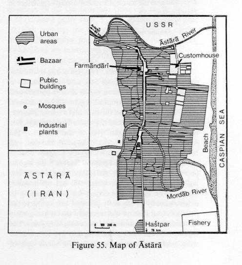
Since 1228/1813, when the treaty of Golestān fixed the frontier between Qajat Persia and the Russian empire on the Āstārā river, the town and district have been divided, the part south of that river belonging to Iran, the part north of it to the Russian empire, the Soviet Union, and since 1991 the Republic of Azarbaijan (Figure 55).
The earliest mention, under the name Astārāb, comes in the Ḥodūd al-ʿālam (tr. Minorsky, pp. 137, 391) written toward the end of the 4th/10th century. In the 8th/14th century, Āstārā became the seat of the small principality of the esfahbad or espahbad (-bod) of Gīlān (J. Aubin, “La propriété foncière en Azerbaydjan sous les Mongols,” Le Monde iranien et l’Islam 4, 1976-77, pp. 107-12). From the 10th/16th to the 12th/18th centuries, the Ṭālešī Khans of Āstārā were either autonomous or nominally subordinate to the governors of Gīlān or Ardabīl; on several occasions they played important parts in the history of the Caspian provinces (A. Olearius, Vermehrte moscowitische und persianische Reisebeschreibung, Schlesswig, 1656, pp. 543, 703-04; J. C. Häntzsche, Talysch, eine geographische Skizze, Dresden, 1867, pp. 49-50).
In the years after the frontier delimitation of 1813, Āstārā, which then consisted of a small commercial town on the Russian side and of little more than a customs post on the Iranian side (W. R. Holmes, Sketches on the Shores of the Caspian, London, 1845, pp. 51-56), became the starting point of an important trade route between Russia and the northwest of Iran. The steep mule tracks over the Ḥeyrān (Ḥāǰǰī Amīr) pass were traversed by increasingly numerous caravans carrying dried fruits, cotton, gall nuts from Kurdistan and the like in one direction, and Russian metal goods and manufactures in the other (N. von Seidlitz, “Handel und Wandel an der Kaspischen Südkuste,” Petermanns Mitteilungen, 1869, pp. 101-03).
After the establishment of the Soviet regime, the frontier was closed and the two towns developed separately. The Iranian harbor, which still handled 16,000 tons in the year 1925-26 (M. Kayhān, Joḡrāfīā III, p. 432), ceased all activity in or around 1940. Trade was then restricted to importation of Soviet food and industrial products by road and, after 1970, exportation of natural gas to the Soviet Union through the Āqā Jārī-Āstārā pipeline.
The Azarbaijani town has a mainly Ṭālešī and Turkish population and is the center of a district (raion) of Azarbaijan. It has a train and bus link to Lankarān and Baku, some food-processing industries dependent on the local fishery and on subtropical produce from local large farms (former sovkhozes), and some woodworking industries. The town stretches along the narrow coastal strip. A large spa in the foothills behind the town and the sandy beach attract a modest touristic activity. The opening of the frontier after the collapse of the Soviet Union did not much profit the Azarbaijani side; its population has slowly grown from 11,950 inhabitants in 1979 to 16,515 in 2009 (according to numbers cited in Bespyatov).
The Iranian town had 14,150 inhabitants in 1976, mostly Shiʿite and Turkish-speaking and partly composed of immigrants from Soviet Azarbaijan. It has a sturgeon fishery and small industrial plants (rice mills, brickworks, tile factory), but is primarily a commercial and administrative center serving the Āstārā district and the northern part of the adjacent šahrestān of Ṭavāleš. It also has a small sea-bathing resort frequented by people from East Azarbaijan (M. Bazin, Le Tâlech, une région ethnique au nord de l’Iran, Paris, 1980, II, pp. 181-84). When the end of the Soviet Union and the accession of Azarbaijan to independence resulted in the reopening of the frontier, that seems to have benefited more the Iranian side of this twin-city, although the author’s visit to the place in 1992 (Bazin, 1996, p. 125 and photograph p. 134) gave him the impression of a moderate rise in activity in the vicinity of the frontier post and the Iranian customs, with groups of Azarbaijani and Russian people practicing the “suitcase trade” (small-scale, uncontrolled cross-border trading) and files of lorries in transit towards Tehran. However, this improved positional value of Iranian Āstārā may have played a role, together with its administrative and commercial function, in driving a rather dynamic demographic growth of the town, from 24,289 inhabitants in 1986 to 40,664 inhabitants in 2006 (Markaz-e Āmār-e Irān).
Until 1963 the small Āstārā district was a baḵš of the šahrestān of Ardabīl, but in that year it was detached from the province of East Azarbaijan and made a šahrestān of the Gīlān. Before the land reform, the Khans of Namīn, who are of Ṭālešī origin but have for long been Turcophone, were big landowners with a strong influence in many villages. The district is the most thoroughly turkicized part of Iranian Ṭāleš. In 1976 the population of the šahrestān (including the town) was 35,000. In 1998, the šahrestān was subdivided into two baḵš: Markazi to the north, including the two dehestān of Virmuni in the lower valley of the Āstārā Čāy and Heyrān in the upper valley, where the Āstārā-Ardabil road crosses the Tāleš chain at the Heyrān pass, and Lavandvil to the south, with the two dehestān of Čelvand and Lavandvil. The population of the district has grown rapidly, from 35,945 inhabitants (including the town) in 1976 to 79,476 inhabitants in 2006. The population is 59.2 percent urban—comprising Āstārā town and the small township of Lavandvil, which is the center of the baḵš and a marketplace (6,372 inhabitants in 2006)—and 40.8 percent rural. The rural inhabitants grow rice, wheat, and vegetables on the coastal plain and wheat, corn (maize), and fruit trees on the lower slopes of the mountains, and graze flocks and herds between qešlāq and yeylāq. Many find it necessary to supplement their incomes with earnings from work as migrant laborers in Tehran and the cities of Gīlān.
Bibliography
M. Bazin, “Le Tâleš revisité,” Studia Iranica 25/1, 1996, pp. 115-34.
Markaz-e Āmār-e Irān, Saršomāri-e ʿomumi-e nofus o maskan [decennial national census], Tehran, 1966-2006.
A. Monaco, “L’Azerbeigian persiano,” Bollettino della Reale Società Geografica Italiana, 1928, pp. 284-86.
Razmārā, Farhang IV, p. 19.
M. Sotūda, Az Āstārā tā Estārbād I, Tehran, 1349 Š./1971, pp. 8-23.
Websites (accessed 30 January 2012).
T. Bespyatov, “Cities & Towns of Azarbaijan,” at http://pop-stat.mashke.org/Azarbaijan-cities.htm.
State Statistical Committee of the Republic of Azarbaijan, homepage at http://www.azstat.org.
Search terms:
| آستارا | astara | aastaaraa |